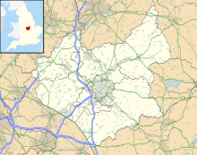
Tugby and Keythorpe
Human settlement in EnglandTugby and Keythorpe is a civil parish comprising the village of Tugby and land surrounding Keythorpe Hall, Hall Farm and Lodge Farm in Leicestershire, England, part of the Harborough district. The Parish covers around 2,200 acres, situated 7 miles west of Uppingham, and 12 miles east of Leicester. According to the 2011 census the population of the parish was 330. The Anglican parish register for the parish dates back to 1568. The boundaries of the parish have not changed throughout the years, meaning that the parish's size remains the same as it did in 1568.
Read article
Top Questions
AI generatedMore questions
Nearby Places

Goadby
Human settlement in England

East Norton railway station
Former railway station in Leicestershire, England

Skeffington
Human settlement in England

East Norton
Human settlement in England

Loddington, Leicestershire
Human settlement in England

Skeffington Hall

Leighfield Forest SSSI

Launde Woods


